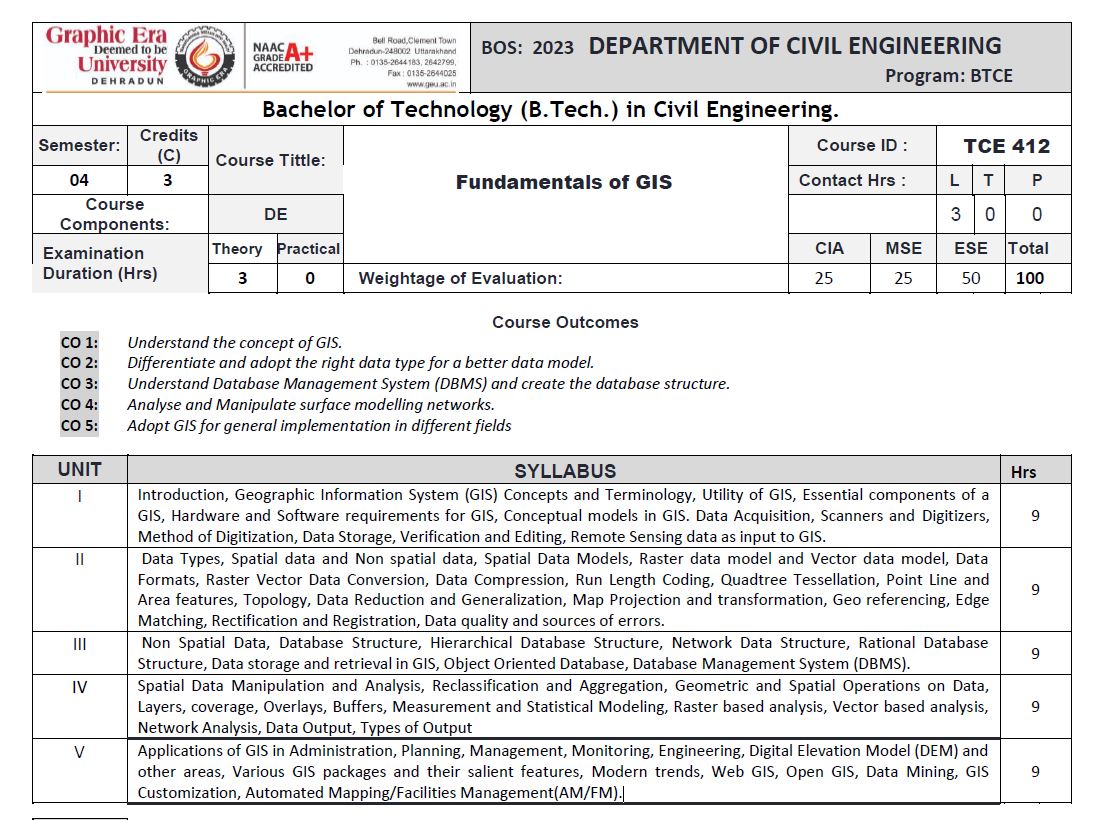
The syllabus provides a comprehensive overview of Geographic Information Systems (GIS), covering fundamental concepts, terminology, and essential components, including hardware and software requirements. It explores data acquisition methods such as scanning, digitization, and remote sensing integration. Spatial and non-spatial data types are examined, along with spatial data models, raster and vector formats, data compression techniques, topology, and error sources. Database structures, including hierarchical, network, relational, and object-oriented models, are discussed in relation to GIS data storage and retrieval. Spatial data manipulation and analysis techniques, such as overlays, buffering, network analysis, and statistical modeling, are covered. The course also delves into GIS applications in administration, planning, engineering, and digital elevation modeling, along with emerging trends in Web GIS, Open GIS, data mining, and GIS customization.
- Teacher: KISHAN SINGH Rawat